 vesseltracker.com
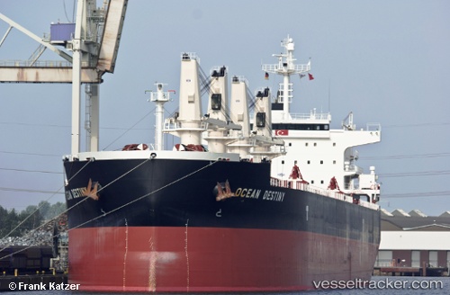
Vessel OCEAN DESTINY IMO: 9485045, MMSI: 636017981 Bulk Carrier
UTC, -23.09447, 38.70730, course: 7, speed: 9.2
UTC, -22.71210, 38.82303, course: 7, speed: 9.5
2026-03-11 13:50:14 UTC, -22.45542, 38.88333, course: 13, speed: 9.9
Live Vessel OCEAN DESTINY Analytics (details, animations, etc.)
Live AIS position: UTC. 203 nm E of Vilanculos), updated 2026-03-11 13:50:14 UTC.Find the position of the vessel OCEAN DESTINY on the map. The latter are known coordinates and path.
marine traffic ship tracker show on live map
The current position of vessel OCEAN DESTINY is -22.45542 lat / 38.88333 lng. Updated: 2026-03-11 13:50:14 UTCCurrently sailing under the flag of Liberia
OCEAN DESTINY built in 2011 year
Deadweight:
55848 tDetails:
Last coordinates of the vessel:
UTC, -23.33745, 38.64990, course: 12, speed: 9.3UTC, -23.09447, 38.70730, course: 7, speed: 9.2
UTC, -22.71210, 38.82303, course: 7, speed: 9.5
2026-03-11 13:50:14 UTC, -22.45542, 38.88333, course: 13, speed: 9.9